Leading Unmanned Aerial Vehicles for Infrastructure Assessment Across Britain in 2025
Published on Sunday, 30 March 2025
The landscape of infrastructure maintenance in Britain has been transformed by advanced unmanned aerial systems designed specifically for professional surveying and structural evaluation. These sophisticated platforms utilise state-of-the-art sensor technology to examine everything from motorway bridges and electrical transmission networks to wind turbine installations and historical listed buildings. The shift towards aerial inspection methodologies represents a significant advancement for UK enterprises seeking to balance operational efficiency with enhanced worker safety protocols. Modern inspection drones combine exceptional durability with precision imaging systems, enabling operators to gather comprehensive diagnostic data whilst minimising disruption to critical infrastructure. Whether you're managing extensive utility networks, conducting routine maintenance inspections, or assessing storm damage across dispersed assets, these unmanned systems deliver measurable improvements in data accuracy, project timelines, and overall cost-effectiveness. The regulatory framework governing commercial drone operations in the United Kingdom has matured considerably, creating a more structured environment for businesses to integrate these technologies into their standard operating procedures. Our detailed examination below showcases five market-leading platforms that have demonstrated particular effectiveness for demanding British industrial applications.
Top Picks Summary
DJI Matrice 350 RTK
The DJI Matrice 350 RTK is the best-in-class choice for heavy-duty industrial inspections in the United Kingdom in 2025 thanks to its enterprise-grade redundancy, long endurance, and modular payload support that make it ideal for complex rail, power and offshore workflows. Compared with the smaller Matrice 30T and Mavic 3 Enterprise it delivers superior flight time, multiple simultaneous sensors and integrated RTK for survey-grade positioning, and while it carries a premium price it reduces operational risk and overall compliance costs for large-scale inspection programmes.

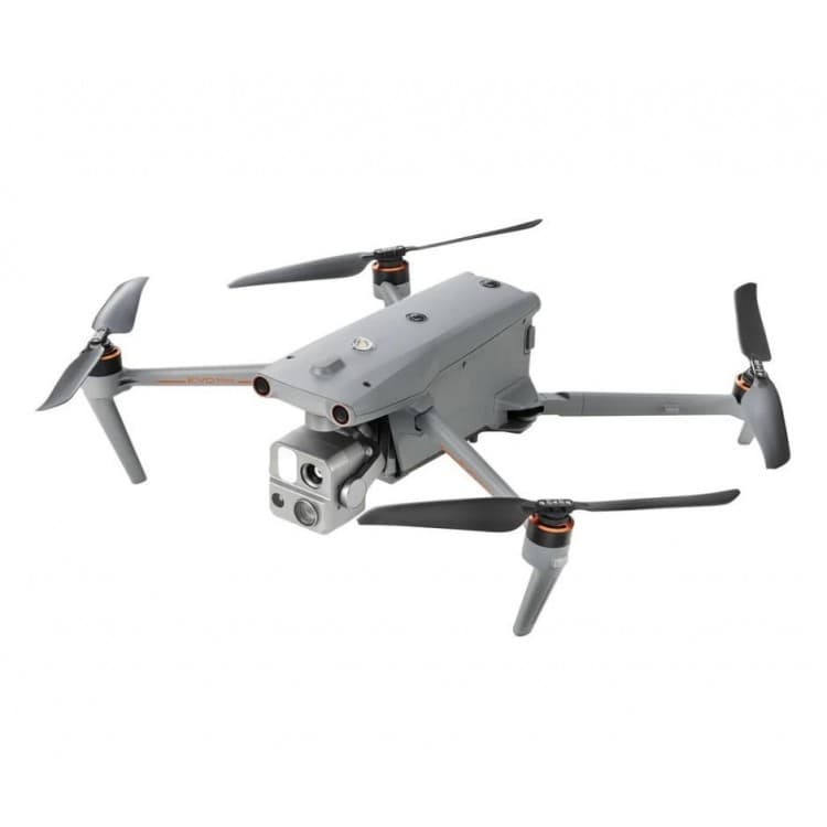
DJI Matrice 30T
The DJI Matrice 30T strikes a strong balance between capability and cost for UK inspectors by combining a compact, rugged airframe with an integrated thermal and zoom sensor suite that is quick to deploy across routine site inspections. It offers many of DJI's enterprise software and service advantages found on the M350 RTK but at a lower acquisition cost and smaller operational footprint, making it a pragmatic alternative for teams that need professional-grade data without the heavier payload or expense of the M350 RTK.

£8,000-10,000 GBP
Autel EVO Max 4T
The Autel EVO Max 4T is a market-leading competitor in 2025, offering high-quality thermal and optical sensors, long endurance and an open software approach that keeps initial procurement and long‑term maintenance costs competitive for UK operators. Technically it rivals DJI on sensor performance and often undercuts on price, and while its domestic UK service network is smaller than DJI’s, its flexible licensing and payload options make it an attractive choice for organisations seeking lower total cost of ownership and less vendor lock‑in.
DJI Mavic 3 Enterprise
The DJI Mavic 3 Enterprise is the best value option for small teams and SMEs in the UK, delivering very portable, enterprise-capable imaging (including zoom and thermal variants) at a fraction of the cost and training burden of larger platforms. Although it cannot match the endurance, payload flexibility or redundancy of the Matrice series or some Autel models, its low capital expenditure and rapid deployment make it ideal for urban infrastructure and first-response inspection tasks where fast ROI and ease of use matter most.

Parrot ANAFI USA
The Parrot ANAFI USA is a lightweight drone that stands out with its unique 32x zoom camera and thermal imaging capabilities, making it perfect for public safety and inspection missions. Its foldable design ensures portability, while advanced safety features enhance operational reliability. With a strong emphasis on data security and ease of use, it is suitable for both professionals and first responders. The ANAFI USA combines innovative technology with versatility, establishing itself as a leader in the compact drone market.

These systems distinguish themselves through integrated thermal imaging suites, extended flight endurance exceeding 45 minutes, robust payload capacity for multi-sensor configurations, advanced obstacle detection systems meeting stringent aviation safety standards, and comprehensive software ecosystems enabling seamless data processing and professional reporting generation suitable for regulatory submissions and stakeholder presentations.
Understanding Professional Inspection Drone Capabilities
Modern industrial inspection platforms represent a convergence of aeronautical engineering and sophisticated sensor technology. These systems operate under specific regulatory frameworks established by the UK Civil Aviation Authority, requiring operators to maintain appropriate qualifications and maintain detailed flight logs. The distinction between consumer-grade and professional-specification unmanned systems centres on payload versatility, environmental resilience, and data processing sophistication.
Thermal imaging sensors detect temperature variations crucial for identifying electrical faults, moisture infiltration, and structural anomalies
LiDAR systems generate three-dimensional point clouds enabling precise volumetric measurements and topographical mapping
Extended battery technology provides operational windows of 40+ minutes, critical for surveying extensive linear infrastructure
Robust design specifications ensure reliable performance across demanding British weather conditions including high wind speeds and precipitation
Integrated flight planning software enables autonomous mission execution with GPS-precision waypoint navigation
Professional-grade stabilisation systems deliver image clarity essential for identifying millimetre-level structural defects
Modular payload configurations accommodate specialised sensors for specific inspection requirements across diverse industries
Real-time data transmission capabilities permit remote monitoring and immediate anomaly detection during active operations
Frequently Asked Questions
Which UAV should I choose for heavy industrial inspections UK?
Choose the DJI Matrice 350 RTK for heavy-duty industrial inspections in the United Kingdom in 2025, because it has an IP55-rated rugged airframe, enterprise-grade redundancy, long endurance, and modular payload support for complex rail, power and offshore workflows.
Does DJI Matrice 350 RTK support centimetre-level positioning?
Yes—DJI Matrice 350 RTK includes integrated RTK and dual-antenna GNSS for centimetre-level positioning and precise mapping.
How does DJI Matrice 30T pricing compare to Matrice 350 RTK?
The provided data doesn’t list any prices for DJI Matrice 30T or DJI Matrice 350 RTK, so a value comparison can’t be made from the available information.
What payload and enclosure rating does DJI Matrice 30T offer?
DJI Matrice 30T uses a compact, rugged foldable airframe with integrated zoom, wide and radiometric thermal sensors, but the provided data doesn’t state an IP rating or a formal warranty duration.
Conclusion
The advancement of professional-grade inspection unmanned systems represents a pivotal shift in how British organisations approach infrastructure management and asset evaluation. The platforms detailed throughout this guide represent the current pinnacle of accessible technology for firms ranging from utility maintenance contractors to civil engineering consultancies. When selecting the most appropriate system for your particular operational requirements, consider not only the technical specifications but also the robustness of UK-based support networks, compliance with Civil Aviation Authority guidelines, and long-term availability of compatible accessory components. The investment in quality inspection equipment typically yields substantial returns through reduced downtime, improved safety outcomes, and more informed decision-making based on reliable aerial data. Should you require further guidance on specific operational scenarios or wish to explore alternative solutions tailored to niche applications, we encourage you to utilise our comprehensive comparison tools and specialist consultation resources.