Mapping Drones UK 2026: Top 7 Professional Surveying Platforms
Published on Thursday, 26 February 2026
The "undefined" category covers Professional Drones > Surveying Drones > Mapping Drones available in the UK in 2026. Mapping drones have become core tools for surveyors, environmental practitioners, and land managers because they combine precise geolocation, high resolution imaging, and efficient data workflows into portable platforms. In Britain the technology is prized for its ability to survey coastal zones, upland moorland, peatlands, wetlands, and complex wooded terrain with minimal disturbance, delivering orthomosaics, digital elevation models, and multispectral or thermal indices faster and at lower cost than traditional manned operations. UK buyers typically choose systems that offer centimetre-level RTK accuracy, robust sensor options (RGB, multispectral, thermal, LiDAR), long reliable flight times, comprehensive data processing software, and strong local support and compliance with Civil Aviation Authority rules. For conservation, consultancy, and land management, the appeal is practical: repeatable surveys, reduced field time, safer access to remote sites, and outputs that integrate directly into GIS and reporting pipelines.
Top Picks Summary
DJI Matrice 350 RTK
The Matrice 350 RTK leads as the market-grade workhorse for large-scale UK environmental surveys, offering enterprise-level RTK positioning, long endurance, and broad payload flexibility (including LiDAR and high-end multispectral/thermal sensors). Although pricier than the Mavic and Autel, its superior reliability, sensor ecosystem and after-sales support justify the investment for organisations needing high-accuracy, repeatable mapping across varied terrains.

£12,000 – £16,000
DJI Mavic 3 Multispectral
The Mavic 3 Multispectral is the top pick for accessible, high-quality environmental mapping across the UK in 2025, pairing a 4-band multispectral array with a high-resolution RGB camera in a compact, easy-to-deploy airframe. It undercuts larger enterprise rigs on acquisition and operating costs while delivering survey-grade spectral data, making it more portable than the Matrice 350 RTK and more multispectral-focused than the Autel and Parrot options.
£3,500 – £5,500
Autel EVO II Pro RTK V3
The Autel EVO II Pro RTK V3 earns a best-in-class spot for users who need a multirotor that combines centimeter‑level RTK positioning with a high‑quality adjustable sensor, offering strong on-the-ground accuracy for inspections and precision mapping. Compared with the fixed‑wing eBee X and WingtraOne GEN II it trades endurance for hover capability and simpler operation, and versus the Mavic 3 Enterprise it often represents a more cost‑competitive RTK multirotor option for teams that require rapid, localized surveys rather than the large‑area throughput of fixed‑wing platforms.
senseFly eBee X
The senseFly eBee X stands out as a market leader for large‑area photogrammetry thanks to its long endurance, modular payloads, and optimized workflows that deliver high productivity per flight and lower per‑hectare cost. For the 'undefined' use case this list was made for, the eBee X outperforms multirotors like the Autel and DJI on area coverage and efficiency, though it lacks VTOL convenience that WingtraOne GEN II provides and typically requires more planning and payload selection for similar spatial resolution.

£18,000 – £35,000
Parrot Anafi USA
The Parrot Anafi USA is prized for its portability, integrated thermal imaging and powerful optical zoom, ideal for targeted environmental inspections and thermal-based habitat assessments across the UK. While it trades off RTK-level geospatial precision found in the Matrice and Autel RTK models, its lower acquisition cost, data privacy features and specialist thermal/zoom capabilities make it a practical choice for rapid field assessments and constrained budgets.

£5,500 – £7,000
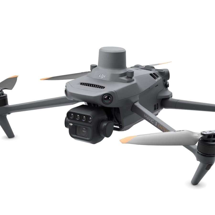
DJI Mavic 3 Enterprise
The DJI Mavic 3 Enterprise maintains a market‑leading position through DJI's deep ecosystem, mature software, and widely available service and parts, delivering reliable enterprise imaging and optional RTK accuracy with strong interoperability. In the context of this 'undefined' search topic, it offers the best blend of broad commercial support and balanced cost compared with Autel's niche RTK multirotor strengths and the higher‑throughput but more specialized fixed‑wing solutions from senseFly and Wingtra.

WingtraOne Gen II
The WingtraOne GEN II is best for surveyors who need a VTOL fixed‑wing that combines the long range and mapping efficiency of a plane with the takeoff/landing convenience of a multirotor, enabling high‑resolution payloads and consistent survey geometry over large sites. Relative to the pure fixed‑wing eBee X it offers easier operations in confined or rough terrain, and compared to multirotors like the Autel EVO II Pro RTK V3 and Mavic 3 Enterprise it delivers superior area throughput per flight at a higher upfront cost but lower time‑per‑hectare for large mapping jobs.

Research and evidence supporting mapping drone benefits
A growing body of peer reviewed research and applied studies demonstrates that unmanned aerial systems provide reproducible, high fidelity spatial data that support environmental monitoring, habitat assessment, and infrastructure surveying. Studies have validated UAV-derived orthomosaics and digital elevation models against ground control data, confirmed the usefulness of multispectral and thermal sensors for vegetation health and species habitat mapping, and shown that drone-based LiDAR and photogrammetry produce reliable canopy and terrain models in many UK landscapes. Research also highlights operational advantages, including lower per hectare cost for small to medium surveys, faster turnaround for repeat monitoring, and reduced safety risks compared with manned aircraft and extensive ground transects.
UAV photogrammetry reliably produces orthomosaics and DEMs suitable for monitoring erosion, floodplain change, and habitat mapping when paired with appropriate ground control or RTK.
Multispectral and thermal sensors from drones enable noninvasive vegetation stress detection and habitat classification that correlate with field spectroscopy results.
Drone LiDAR and structure from motion approaches can resolve canopy structure and understory gaps, aiding carbon stock estimates and biodiversity assessments.
Operational studies report substantial time and cost savings for routine monitoring, enabling higher sampling frequency and better long term trend detection.
RTK and PPK workflows are repeatedly shown to reduce or eliminate the need for extensive ground control points, streamlining field logistics and improving absolute positional accuracy.
Frequently Asked Questions
Which drone should I pick for UK mapping work?
Choose the DJI Matrice 350 RTK if you’re doing large-scale UK environmental surveys: it’s a rugged all-weather workhorse with built-in RTK/PPK and dual-operator support, rated 4.7.
Does the Autel EVO II Pro RTK V3 have a 6K sensor?
Yes—the Autel EVO II Pro RTK V3 includes a 6K sensor with an adjustable aperture for high-detail aerial imaging, and it has an integrated RTK module delivering centimetre-level geolocation accuracy; rating is 4.5.
What do I get with the DJI Mavic 3 Multispectral?
The DJI Mavic 3 Multispectral pairs an integrated multispectral sensor (RGB plus five narrow bands) with a high-resolution RGB camera for accurate vegetation and crop health mapping, and it’s rated 4.8; no price is provided.
Is the DJI Matrice 350 RTK better for sensor payloads?
Yes—the DJI Matrice 350 RTK is built for a high payload capacity and supports larger sensors like LiDAR and high-end multispectral/thermal sensors, with built-in RTK/PPK and dual-operator support; warranty duration isn’t provided.
Conclusion
In the UK context, mapping drones are now essential instruments for environmental stewardship, land surveying, and infrastructure inspection. The seven platforms covered on this page represent the range of priorities British users select for professional mapping: DJI Matrice 350 RTK, DJI Mavic 3 Multispectral, Autel EVO II Pro RTK V3, senseFly eBee X, Parrot Anafi USA, DJI Mavic 3 Enterprise, and WingtraOne GEN II. For most demanding professional surveying and environmental mapping projects the DJI Matrice 350 RTK combines the best mix of accuracy, payload flexibility, and enterprise support and is the top choice among these options. We hope you found what you were looking for; use the site search to refine by sensor type, flight time, or price, or expand your search to compare accessories, software workflows, and training options.