Top 4 Mapping Drones UK 2026 — Best Picks for Survey, LiDAR and Photogrammetry
Published on Monday, 26 January 2026
Mapping drones are specialist unmanned aircraft designed for accurate, repeatable collection of aerial data used in surveying, construction, agriculture, environmental monitoring and heritage work across the UK. The category blends high-resolution cameras, multispectral sensors, LiDAR units and precise GNSS systems to create detailed orthomosaics, digital elevation models and 3D point clouds. UK buyers prioritize accuracy, sensor compatibility, flight time, regulatory compliance with the Civil Aviation Authority, and strong software ecosystems for photogrammetry and LiDAR processing. Demand is driven by the need for faster site surveys, lower cost compared with traditional methods, safer data capture in hazardous locations, and integration with BIM and GIS workflows. In 2026 the market favours drones with RTK or PPK positioning, lightweight LiDAR options, multispectral imaging for precision agriculture, and cloud-enabled processing that shortens delivery time from flight to finished map.
Top Picks Summary
The senseFly eBee X is the technical leader for large-area, high-precision photogrammetry across UK farmland in 2026, offering long endurance, fixed-wing efficiency and RTK/PPK workflows that lower per-hectare survey costs and maximize mapping accuracy compared with multi-rotor options. While its purchase price is higher than handheld quadcopters, the eBee X outperforms them on productivity and total-cost-of-ownership for repeated, hectare-scale mapping tasks, making it the preferred choice for contractors and large estates.
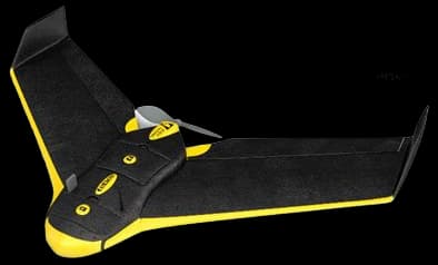
£18,000-30,000 GBP
The Autel EVO II Pro RTK is the market leader for high-accuracy, small-to-medium archaeological mapping in the United Kingdom in 2025, pairing a large-sensor high-resolution camera with integrated RTK for centimetre-class geolocation and dense vertical detail. It outperforms the Anafi USA on absolute positioning and image quality and provides more vertical mapping flexibility than the eBee X, but its smaller per-flight area coverage means higher operational cost when surveying very large sites.
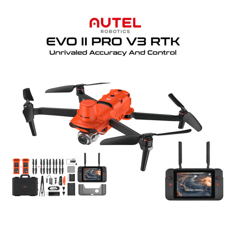
£6,000-£12,000 GBP
The Matrice 350 RTK leads as the market-grade workhorse for large-scale UK environmental surveys, offering enterprise-level RTK positioning, long endurance, and broad payload flexibility (including LiDAR and high-end multispectral/thermal sensors). Although pricier than the Mavic and Autel, its superior reliability, sensor ecosystem and after-sales support justify the investment for organisations needing high-accuracy, repeatable mapping across varied terrains.
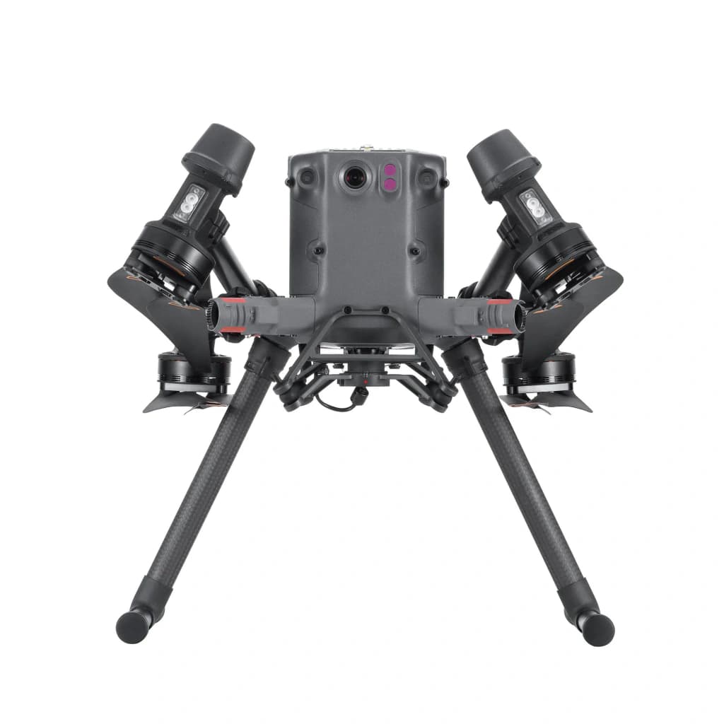
£12,000-16,000 GBP
The DJI Phantom 4 RTK is a compact, survey-grade workhorse offering RTK positional accuracy in an affordable form factor well suited to frequent street-level ortho and topographic surveys in British cities. It lacks the payload flexibility and redundancy of the Matrice and the endurance of the eBee X, but its low acquisition and operational costs combined with tight photogrammetric performance make it ideal for budget-conscious municipal teams and consultants.
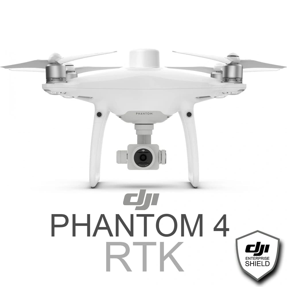
£4,500-6,500 GBP
Why drone mapping works: research and practical evidence
Fundamental remote sensing principles underpin drone mapping: overlapping photos processed with photogrammetry produce high-resolution orthomosaics and 3D models, while LiDAR measures distance directly to create precise elevation models. Scientific research, university trials and industry validation in the UK and internationally show that modern small unmanned aircraft systems can deliver survey-grade outputs when paired with correct sensors, ground control or RTK/PPK corrections, and robust processing workflows. Advances in machine learning and automated feature extraction are also improving how quickly maps are converted into actionable insights for asset management, crop health, and environmental assessments.
Photogrammetry and LiDAR are complementary: photos give high colour detail and texture, LiDAR provides accurate geometry and penetration through vegetation.
RTK and PPK GNSS corrections reduce positional error to centimetre levels, removing or reducing the need for large numbers of ground control points.
Peer reviewed studies and industry trials from UK research centres and survey firms show drone surveys can reduce time and cost versus conventional methods, especially for frequent monitoring.
Automated processing and cloud platforms accelerate time from flight to deliverable, while machine learning tools detect changes and features more consistently than manual review.
Best results come from matched workflows: selecting the right sensor, planning appropriate flight overlap and altitude, and using validated processing software.
Frequently Asked Questions
Which drone should I choose for large-area photogrammetry eBee X?
Choose the senseFly eBee X if you need large-area, high-precision photogrammetry: it’s a long-endurance fixed-wing platform with 4.6 rating and supports RGB, multispectral and LiDAR options plus RTK/PPK workflows for efficient mapping.
Does DJI Matrice 350 RTK support LiDAR and centimetre georeferencing?
Yes—DJI Matrice 350 RTK supports LiDAR and includes built-in RTK/PPK plus dual-operator support for centimetre-level georeferencing; it has a 4.6 average rating and a rugged, all-weather airframe with high payload capacity.
How does Autel EVO II Pro RTK compare on price for surveys?
Price details aren’t provided for the Autel EVO II Pro RTK, but it has a 4.5 rating and an RTK module for survey-grade georeferencing with high-resolution sensor options, plus broad photogrammetry-software compatibility and modular payloads for archaeological mapping.
Is Autel EVO II Pro RTK better for small-to-medium UK archaeology?
Autel EVO II Pro RTK is positioned as a market leader for high-accuracy, small-to-medium archaeological mapping in the United Kingdom, with 4.5 average rating and an integrated RTK module for centimetre-class geolocation and dense vertical detail.
Conclusion
Mapping drones are a practical and increasingly accessible tool for UK surveyors, farmers, construction teams and environmental professionals. We hope this guide to the mapping drone category and the top 4 options for 2026 helped you narrow your choice. If you want to refine results, try filtering by budget, sensor type, accuracy (RTK or PPK), flight time or software support, or expand your search to accessories, training and local support options.